Route Length
Max Altitude
Trek Duration
Trek Difficulty
Base Camp Area
Pickup Point
10+ Years Age
First timer can apply, previous trekking experience is more appreciated.
Cover 5 km of distance in 30 minutes without a stress.
+91 7055048487, +91 7055048488
trekkingcompass@gmail.com
India has a few summit climbs, but they are exceptionally beautiful. These include the easier ones like Chandrashila, Kedarkantha, etc., and the difficult ones like Stok Kangri at 20,000 ft. Among these stark opposites, there's a sweet spot called Pangarchulla Peak Trek. It has the ease of Kedarkantha and the thrill of Stok Kangari.
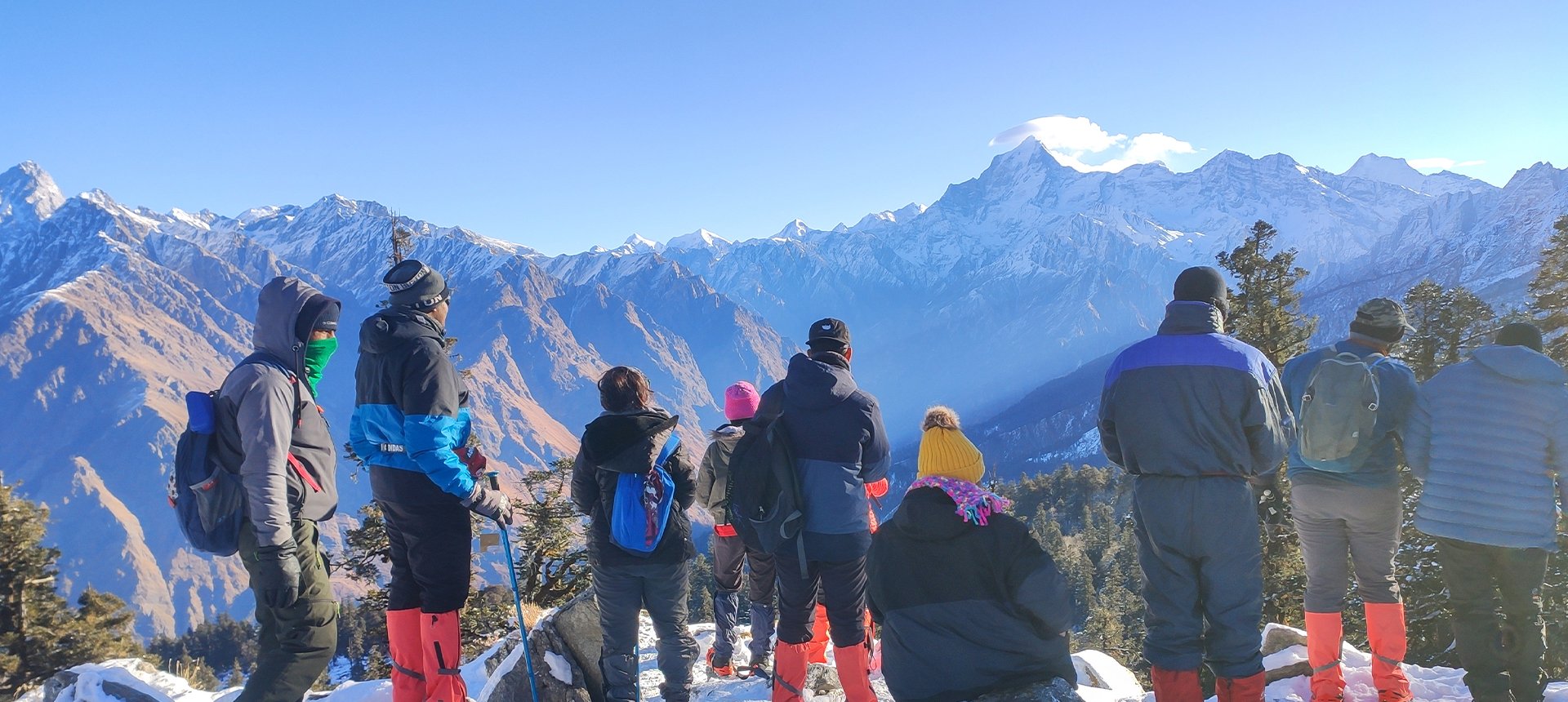
The appeal of the Pangarchulla Peak trek lies in its challenges. It's a truthful statement until its offerings make an appearance. Pangarchulla Peak Summit is one of the two things you conquer during this trek, the other one is Kuari Pass Summit. Stretched for 7 Days, this trek gives you your money and time's worth. You have unmatchable views of mountain peaks like Mt. Kamet, Gauri Parvat, Mt. Dronagiri, and Mt. Nanda Ghunti.
When trekkers think that's all, this trek offers more. They are Neelkanth Peak, Lampak 1 and 2, Mt. Changabang, Kalanki Parvat, Mt. Trishul, Hathi Pravat, Chaukhamba massifs, etc. The main attraction for this trek is the 4,000 ft ascent within a timespan of 12 to 13 hrs. The trek is challenging, and rewarding, and offers a 10 m sharp ridge. If you like adventure, Pangarchulla Peak Trek is for you. It is open from April to mid-May in light of the perfect snow layer to cross the boulders.
For someone who has treks like Rupin, Kedarkantha, and Roopkund; Pangarchulla should be the next step. Come prepared for the extreme weather and challenges to have the time of your life!
Sailang Altitude: 5,800 ft (1767 m)
Altitude Gain: 4680 ft (1426 m)
Travel Distance: 244 km
Travel Hours: 7 to 8 hrs (approx.)
The morning after trekkers have travelled to Rishikesh, the journey to Sailang will start. Sailang is a small village at a distance of approximately 244 km from Rishikesh. The drive there takes 7 to 8 hours, but the promising next day and the views along the way make it a cakewalk.
Sailang is our choice of stop, others also choose Joshimath, Karchi, Peepalkoti, etc. From Sailang, your drive to the base village Tugasi is 1 hour (maximum) and then we trek beyond that point. Sailang village humbles you with the enormous mountains standing in your view. One prominent view is of Mt Dronagiri, it's not completely visible, but its towering peak won't let you forget its presence.
While on your way to Sailang, you'll drive through spiralling hilly roads and pine trees lining the roads. These pine trees are fringed across the steep hills and even steeper valleys. Altogether, they remind you that beauty is in the finer details of nature. You'll pass through 4 Prayags on your way to Sailang. These are Devprayag, Rudraprayag, Karnaprayag, and Nandaprayag.
Once you reach Sailang after the long day's journey, you will get to rest at the lodging and acclimatize yourself. This stop will also be your last stop to keep your batteries charged. You'll not get that time at Tugasi village as the trek to Gulling Top will start.
Guling Top Altitude: 9,100 ft ( 2,7740 m)
Altitude Gain: 3,300 ft ( 1,006 m)
Travel Distance: 14 km + 3 km (17 km)
Travel Hours: 1 hr + 2 to 3 hrs = 4 hrs (approx.)
You'll open your eyes to a beautiful sunset at the Nanda Devi peak from Sailang. After the regular day's drill and the briefing, everyone will onboard their vehicles. An 8 km and 1 hr long drive later, you'll be at Tugasi. This is a small village that serves as the base village for the Kuari Pass trek. Here you'll get a chance to see the lives of people in villages nestled in the mountains.
At Tugasi, trekkers will descend up the stony trail with Gulling Top in their minds. While moving up the trail, you'll see Mt. Nanda Devi’s peak accompanying you throughout. Once you walk a little further up the trail from Tugasi, you'll see fringed houses of villagers around the trail. This will give you a chance to interact with the locals, especially the innocent children.
Throughout the trail, a variety of trees will accompany you including apricot trees. The apricot trees are also a reason for the campsite to be called Akhrot Getta. The trail won't be a quiet one with the sounds of Himalayan Monal and griffin. On rare occasions, you can expect to spot these birds in all their allure.
Gulling Top campsite is a clearing nestled within oak trees (green and golden) lining the campsite. This campsite is where you can be certain to see snow as verglas or fresh snow. At times you'll sleep inside your tents and in the morning, the snowfall will have coloured your tents a magical white. The views from here are to Mt. Dronagiri, Mt. Nanda Devi, and Hadi-Ghoda Parvat. You will especially see their beauty when the sunrays dance on these peaks.
Khulara Altitude: 11,000 ft (3,350 m)
Altitude Gain: 1,900 ft (579 m)
Travel Distance: 5 to 6 km
Travel Hours: 4 to 5 hrs (approx.)
Today’s morning will mark another ascent of 4 to 5 km to our next campsite, Khullara. Khullara brings vivid views of mountains and a beautiful clearing to set your camp. The oak trees line up in the background of your camps. This view morphs into incredible when the sky turns purple, pink, orange, and sometimes yellow.
Khullara campsite is different and beautiful in different seasons. Nothing tops its beauty during winters when the campsite is snow-covered; white as a dove’s feather. This also calls for trekkers to put on sunglasses while trekking to and from the Khullara campsite. The rhododendrons, oaks, and deodars around the campsite when covered with snow make you believe in magic.
If you admire mountain views, Khullara campsite won't disappoint you either. You'll get an outstanding view of the peaks like Nanda Kot, Dronagiri, Lampak 1 and 2, Hathi Parvat, and Ghoda Parvat. You'll rest here for the day and enjoy the flora and fauna around. All the while you'll acclimatize yourself for the climb awaiting you tomorrow
Kuari Pass Summit Altitude: 12,500 ft (3,800 m)
Altitude Gain/Loss: 1,500 ft (457 m)
Travel Distance: 6 km + 6 km (12 km approx.)
Travel Hours: 8 to 9 hrs (approx.)
Today will be the reward day of your 3-day long journey. After the early morning breakfast, trekkers will start ascending towards Lord Curzon's trail. This will lead them right to the Kuari Pass Summit which is at a distance of 6 km (4 to 5 hrs approx.) from Khullara campsite.
On your way up you'll pass through small grass clearings and dense oak forests. For the final climb where the Kuari top is visible, you'll leave the trees behind. All that's to see will be a pasture land which is vast and appears to extend till infinity. When covered with snow, you can also expect to see footprints of Himalayan bears and snow leopards. If time allows you’ll also ascend Khullara Top. Its views and beauty are a standalone.
The climb is steep and you'll find relief at your destination. If we are lucky, we'll catch the sunrise at Kuari Pass Summit. Kuari top has an old shrine where devotees bow down to their deity. For explorers, the Kuari Top has incredible views of 22 different peaks. Among these peaks are some popular ones like Mt. Nanda Devi (25,643 ft), Mt. Dronagiri (23,182 ft), Hathi-Ghoda peaks (22,070 ft), Pangarchulla Peak (15,069 ft), Mt. Neelkanth (21,640 ft), Chaukhamba Massif (23,419 ft), and Mt. Kamet (25,446 ft).
Pangarchulla Peak Altitude: 15,069 ft ( 4,593 m)
Altitude Gain/Loss: 4,069 ft (1240 m)
Travel Distance: 14 km ( approx.)
Travel Hours: 12 to 13 hrs (approx.)
Unlike other treks, Pangarchulla Peak Trek requires you to wake up early around 2 to 4 in the morning. You will carry your packed breakfast and make a move for the peak. It's advisable to keep a windcheater to check the chilly winds around the ridge and the summit.
The day begins with an ascent from Khullara Campsite, the first patch you'll cross is a forest. Soon, you'll lose the trail of the forest and will be out in the vast meadows. At Jhandi Top, you will move towards the Pangarchulla Peak trail. At the same point, another trail leaves for the Kuari Pass.
Walking along the ridge, you'll see different mountain views that'll get more prominent and proximus on climbing further. Soon you'll reach the trail filled with huge boulders. Experienced trekkers believe it's easier to trek this section during snow. The snow covers the gaps and makes it easier to walk through.
Eventually, you'll be at the last stretch for Pangarchulla Peak, it's after you cross the mini Pangarchulla. This portion is steeper than before and thus a difficult climb. It's also why trekkers find this trek challenging in comparison to other summit treks like Chandrashila, Kedarkantha, etc.
Once you are at the summit, you have mesmerizing views of hills and mountains. The views of Mt. Nanda Ghunti, Mt. Dronagiri, Gauri Parvat, Mt. Trishul, Hathi Parvat, Changabang, Hanuman Peaks, Kalanki Parvat, Lampak 1 and 2, and Chaukhamba massifs are unparalleled. Other peak-worthy peaks are Mana Parvat, Mt. Neelkanth, and Kamet Peak. You can also see Tungnath, Brahmatal, and Rudranath trail peaks from here.
After spending considerable time on the summit, it'll be time to descend seeing the long nature of the trek. At Khullara, you get a well-deserved rest after 12 to 13 hrs of trekking.
Sailang Altitude: 5,800 ft (1767 m)
Altitude Loss: 5,200 ft (1,585 m)
Travel Distance: 9 km + 14 km ( 23 km)
Travel Hours: 6 hrs + 1 hr ( 7 hrs approx.)
The day begins with a beautiful sunset at Khulara and a descent from Khullara to Gulling Top. Taking the alpine glow on the Nanda Devi peak in your eyes, you'll trek down towards Tugasi village. All the memories of your ascent will encircle you in the form of the dense oak forest with fringed rhododendrons and deodars.
For the last time while trekking down, you'll be accompanied by Nanda Devi peak till Tugasi village. At Tugasi you'll onboard the vehicles that'll take you to Sailang. En route, there will be views of Bhadreshwar Mount valley. Besides this, you can make a stop to get a view of Vishnuprayag. It's one of the 5 confluences where the Dhauliganga River meets the Alaknanda River. The vehicles will soon come to a stop at Sailang village.
Trekkers will rest here for the day and enjoy campfires, stories, and gossip. You can interact with the locals and experience the beauty and culture of the hills. Other than that, a beautiful sunset will greet you with the Nanda Devi Parvat’s peak shining bright with red, orange, purple, and yellow heu.
Rishikesh Altitude: 1,120 ft ( 340 m)
Altitude Loss: 4680 ft (1426 m)
Travel Distance: 244 km
Travel Hours: 7 to 8 hrs (approx.)
Today marks your day back from Sailang. All you'll have left with the memories of climbing atop the Kuari Pass Summit. For many, one trek won't be enough and they'll like to return and explore more. A reason for you to come back is the trail down from Kuari Pass Summit that goes through Tali Forest Campsite to Tali Lake. This trail then takes you to Gorson Bugyal, a less-explored, almost exotic part of the various bugyals in the Garhwal region of Uttarakhand.
On this trail, you'll also have a chance to ascend Jhandi Top. This place offers beautiful views, but it tops all viewpoints with its unsurpassable view of Mt. Nanda Devi. This view isn't just any view, it's the famous South-West face of Mount Nanda Devi. Trekkers say that it's as if they are in front of the deity themselves when glancing at Mt. Nanda Devi. When you descend more, you'll have Auli to greet you with outstanding views of the Garhwal Himalayas.
The route from Sailang to Rishikesh offers views of the 4 confluences that lead to the formation of the River Ganges (Maa Ganga). You can see the Nandakini, Pindari, Mandakini, and Bhagirathi river confluence into Alaknanda and finally Ganges. For devotees, the route itself is auspicious as it's the route to Badrinath Temple. Other considerable stop points on the route are Dhari Devi Temple, Koteshwar Temple, Siddhanta Temple, Maa Uma Devi Temple, Latu Devta Temple, Shree Garuda Temple, and Vridhi Badri Temple.
Accommodation
Meals (Vegetarian only with eggs option available)
Nutritious meals from Day 1's dinner to last day's breakfast, following the itinerary schedule.
Expert Support
First Aid Preparedness
Fully equipped medical kit including a stretcher, oxygen cylinder, blood pressure monitor, oximeter, and stethoscope to ensure safety throughout the journey.
Storage Facilities :- A secure room at the base camp to store additional luggage not needed during the trek.
Permits and Entry Fees :- Coverage of all necessary permits and entry fees, in line with standard charges for Indian nationals.
Transportation :- A round-trip transport from the pick-up point and back at the same point as a part of the itinerary.
Trek Equipment
Insurance :- Personal insurance is mandatory and not included in the package.
Personal Expenses :- Any expenses of a personal nature, including shopping, snacks, hiring a mule or porter for carrying your belongings, or acquiring personal equipment.
Emergency Costs :- Expenses arising from emergency evacuations, hospitalization, or any medical treatments required.
Unspecified Services :- Any services or items not explicitly mentioned under the "INCLUSIONS" section.
Food Costs :- We will not cover any food costs during your transit to and from the base village.
Trekking is not only about enjoying the change of scenery but also about being responsible. Our (Trekking Compass) responsibility is to provide you with an opportunity for a safe trek. But, how do we do that? We do that when you fulfill your end of the responsibility and are honest with us. To keep you safe we need to be sure there isn’t any inherent threat to your being.
Treks are at higher altitudes and it becomes difficult, almost impossible to provide you with immediate medical assistance. Therefore, we cannot help you if you don’t help us. Trekking is only one of the things you can do, but there are plenty of other things to do too. Don’t risk your life for the thrill.
To approach a trek with utmost safety, we want you to submit the following documents:
Personal Confirmation Statement (Compulsory for anyone over 18 years)
You are participating in a trek at high altitudes and it comes with its own sets of risks. This Personal Confirmation Statement will make sure that you understand all the risks you're buying into. Trekking Compass wants you to confirm your complete understanding of these risks so that you come prepared for any mental or physical challenges ahead.
This statement is also a declaration from you that, "All the information I have provided, including medical conditions, is true. If found false under any circumstances, I will be held accountable and it has nothing to do with Trekking Compass."
We have the utmost empathy for you and will do our best to help wherever possible, but only after assessing your readiness and safety for the trek. This is how our team will adequately prepare for whatever risks we might face during the journey. Concerning individuals are requested to thoroughly cross-check the requirements and only then sign the document.
Parent/Guardian Approval Statement (Compulsory for anyone below 18 years)
For participants under 18 years of age, the Parent/Guardian Approval Statement is essential to confirm that a legal guardian understands and consents to the participation in the trek. Once we have this document, we are affirmed that the parent or guardian is fully aware of the risks involved in trekking at high altitudes and is consenting to their child's participation.
No underage (below 18+) children are welcome on the trek without their parent's consent. Submission of this document reassures us that parents are approving that their child meets the health and fitness requirements for the trek, after a thorough examination.
This legal confirmation holds the parent liable for any discrepancies, freeing Trekking Compass from any liabilities for the same. Parents are requested to thoroughly cross-check the requirements and only then sign the document.
Medical Liability Waiver
The Medical Liability Waiver makes sure participants acknowledge the health risks associated with trekking at high altitudes. Common ailments during treks include altitude sickness, dehydration, muscle cramps, hypothermia, and fatigue, all of which can significantly affect your trekking experience. Additionally, weather changes and the physical demands of the terrain may exacerbate pre-existing conditions.
If you have pre-existing medical conditions such as asthma, diabetes, or heart issues, it’s vital to inform us and carry your necessary medications. Trekking Compass cannot provide immediate medical assistance in remote areas, so having the essential medications, such as inhalers, insulin, or any other prescriptions, is crucial for your safety during the trek.
By signing this waiver, you confirm that you are in good health and have taken the necessary precautions. You acknowledge these risks and agree not to hold Trekking Compass liable for any medical issues or accidents that may arise during the trek.
For any further doubts about anything mentioned above, below is our contact information:
OFFICE ADDRESS: Lane No. 4 Krishna Vihar Mohkampur, Dehradun, Uttarakhand, 248005
PHONE NUMBER: +91 7055048487, 7055048488
EMAIL ADDRESS: info@trekkingcompass.com
HOW TO REACH ? (RISHIKESH)
Note: Keep a buffer day in your getaway in addition to the total days in the itinerary. This day will come in handy in case of any political unrest, landslides, or rains. If not, you can use the extra day to get to know Rishikesh. This means that for an itinerary ending on the 15th of a month, book your return tickets for the 16th.
What are the different ways to reach Rishikesh?
On the Pangarchulla Peak trek, our first long-day trip is from Rishikesh to Sailang (244 km). Therefore, trekkers need to reach Rishikesh to start the trek. The first move to reach Rishikesh for any trekker is to reach either Dehradun or Delhi. Later, every trekker can choose their choice of transport. The available transports for Rishikesh are:
Medium: BUS
A Friendly Note: You should travel by government buses instead of private ones because the private buses tend to take more time than expected. To avoid missing the pick-up time, try traveling by government bus, wherever possible.
Medium: TRAIN
Medium: FLIGHT
Fly Directly to Dehradun and then to Rishikesh: To fly directly at Jolly Grant Airport Dehradun, there are multiple flights from metropolitan cities. The companies that facilitate these flights are:
Fly to Delhi then take a bus or train to Rishikesh: It’s very easy to fly to Delhi from anywhere in the country and take a bus to Rishikesh. You will find a detailed description of buses in the BUS section. The companies that facilitate these flights to Delhi are:
Note: Make sure that the mode of transport you choose should bring you to Rishikesh a day before Day 1, i.e., Day 0. You can fly to Delhi and Dehradun from Mumbai, Kolkata, Bengaluru, Chennai, Hyderabad, Pune, and to Dehradun from Delhi too.
What happens on the drop-off day
Here are the points that explain your drop-off:
Special Case: What if you miss our pick-up?
You shouldn't panic and follow one of the below-mentioned ways to Joshimath:
| Backpack with rain cover / Trolley Bag | Main bag for gear. |
| Day pack with rain cover (20 - 30 L) | For day essentials, if the main pack is off-loaded. |
| Walking stick | Recommended (at least one). |
| Water bottle/ Hydration pack | 2 bottles (1L each) or 1 hydration pack and 1 bottle. |
| Snacks | Energy bars, dry fruits, ORS/electrolytes. |
| Personal Medical Kit | As prescribed by your doctor. |
| T-shirts (Synthetic, quick-dry) | 2 full-sleeve, 2 half-sleeve. |
| Fleece T-shirts | 2 pieces. |
| Wind-stopper / Fleece jacket (upper) | 1 piece. |
| Windproof jacket | 1 piece |
| Down feather / Hollow jacket | 1 piece |
| Thermal innerwear (Upper & Lower) | 1 set. |
| Trekking pants (Synthetic, quick-dry) | 3 pairs. |
| Wind-stopper / Fleece pants (lower) | 1 pair. |
| Waterproof gloves | Not required. |
| Fleece / Woolen gloves | 1 pair. |
| Poncho / Waterproof jacket and pants | 1 set. |
| Head torch / Hand torch | 1 piece. |
| Sun cap | Required. |
| Woolen cap | 1 piece. |
| Balaclava | 1 piece. |
| Buff/ Neck gaiters | 1 synthetic, 1 woolen. |
| Sunglasses | UV protection with side covers (for spectacle users: contacts or photochromatic lenses). |
| Trekking shoes (waterproof, high ankle, good grip) | 1 pair. |
| Floaters / Flip-flops | 1 pair. |
| Cotton socks | 4 pairs. |
| Woolen socks | 2 pair. |
| Sunscreen | 1 piece. |
| Moisturizer | 1 piece. |
| Lip balm/ Chap-stick | 1 piece. |
| Toothbrush and toothbrush | 1 set. |
| Toilet paper and wipes | 1 pack each. |
| Soap/ Hand sanitizer | 1 piece. |
| Quick-dry towel | 1 piece. |
If you qualify for the health and fitness requirements for the trek, you are qualified for the trek. Acclimatization issues arise if you do not meet the health and fitness requirements and become a hassle for everyone. So, opt for the trek wisely.
Trekking Compass will provide two categories of twin-sharing tents. They are 2+1 & 3+1. 2 to 3 people can stay comfortably in these tents.
Here are the mandatory documents during the trek:
No, we do not offer any discounts at present. For trekkers cashing in their cash vouchers, their trek charges will be reduced to the Total Trek Charges - Cash Voucher.
Yes, children of 9 years and above age are allowed on the trek. This might change depending on the trek conditions and season of choice.
There are different rules for different sets of children. They are:
For both sets, Medical and Disclaimer forms are compulsory on the trek.
Yes. You can get jackets, trek poles, and other trekking equipment on rent from Trekking Compass.
We have toilet tents where you can go about your business, these dry toilets are nature-friendly and convenient. You can choose the shove-pit-mud method too, which is nature-friendly and maintains cleanliness and hygiene. Carry essential toiletries, maintain good hygiene, and enjoy the trek.
Here is how you can update your family:
No. The children will be served the same nutritious meals as the adults during the trek. There will be Breakfast, Lunch, Snacks, and Dinner. Any additional dietary requirements requested for the children will be taken care of by our kitchen staff. These will especially be for children with certain allergies or lactose intolerance.
You can contact us (Trekking Compass) with detailed queries at trekkingcompass@gmail.com. We will make sure to resolve your queries as fast as we can. Please note that we will not accept any changes 24 days before the trek’s start date. In these cases, our usual cancellation policy will apply.
There is no weight limitation on the luggage to carry that is imposed on you by Trekking Compass. In our humble opinion, we suggest you carry light luggage to fully enjoy the trek.
No. Your weight will not be an issue. Although, you must meet the health and fitness requirements for the trek. This helps you avoid any fatal complications during the trek.
This trek involves a combination of both. You reach the base village by drive and then it's a trek, then a drive back to Dehradun or Rishikesh.
